.png)


My research group focuses on the impact of climate change on agriculture, and in particular on two types of agriculture: so-called heroic agriculture, which makes use of terracing in areas with steep slopes, and coastal agriculture, which we have been working on for the last three years. To study these two types of agriculture, we are making massive use of big data from satellites and drones to quantify the impact of climate change in two extreme conditions: excessive rainfall, i.e. intense and localised rainfall that causes soil degradation, erosion, landslides and hydrogeological instability, especially in hilly areas; and drought, a phenomenon that can affect the agriculture of entire nations, as happened in Spain, France, Italy and many parts of Europe in 2022.
Oh yes, definitely.
That's right, my research group is working to understand the impact of drought on both hilly and - especially - coastal agricultural areas. The aim is to use the information we obtain to identify adaptation solutions that promote sustainable water use and are sustainable (with low environmental impact). One example is the collection of water during a rainy phase and its storage in micro-ponds for reuse during emergencies and water shortages. The aim is also to understand how agriculture can adapt to increasingly frequent and severe droughts through targeted interventions.
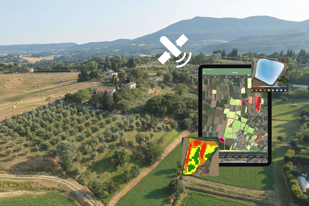
Computer vision and remote sensing are very important. All the collaborators in my research group use cloud platforms to access massive satellite data in an open access format and then analyse it. For example, to study the vigour of vegetation during periods of water stress. But we also use a lot of drones, processing the images they take with computer vision to create very high-resolution three-dimensional models of terraced areas where heroic agriculture is practised, using the Structure from Motion photogrammetric technique. We can then use these models to simulate an intense rainfall event and map out areas where a slope could suffer erosion or a crisis, such as a landslide. And farmers can use this information to prevent and mitigate these phenomena, and even actively contribute to mitigating hydrogeological disruptions.

By analysing satellite data, we can study the phenomenon on a large scale. For example, we can use satellites to identify areas where vegetation is struggling to grow due to stress conditions. By comparing this data with analyses carried out in previous years, we can also assess the severity of the situation in perspective, taking into account the historical record, and from this we can produce hazard maps and identify so-called hot spots where vegetation is under stress due to waves of drought. In our work on coastal agriculture, we do this analysis by combining it with data on salt wedge intrusion, which is becoming a major problem along the coasts, especially in the deltas. The Po is an example.
During dry periods, the river's flow rate drops and sea water flows up the branches of the delta. This causes salt water to infiltrate the soil, which can have a serious impact on agricultural land, leading to micro-desertification and large areas of land under salinity stress. Processing data from satellite imagery allows this process to be understood at its true scale, because it is possible to understand when and to what spatial extent vegetation is stressed.
Exactly. In fact, once you have the map of hot spots, you can enrich it with other information, such as the type of agriculture practised and the crops grown. In this way, you can target interventions very precisely. This is very important because one of the most common mistakes is to think that you can apply the same solution to the problem of drought, for example, or to the problem of soil erosion on hills all over Europe. This is wrong, because each place has its own characteristics in terms of climate, soil, culture and traditions, and interventions must be designed with all this in mind.
Absolutely, precision farming is all about being able to intervene where it is needed, at the right time and with the right amount of water, fertiliser or whatever input. For all this, at any scale, it is important to have maps based on data, which is why satellites or drones can become indispensable tools to provide guidelines for specific and effective interventions.
AI is the future, whether we like it or not. It is a revolution in which it would be wrong not to participate. It is inevitable that, with big data (massive, increasingly accurate data generated in a short period of time from different sources) and the computational power of increasingly sophisticated machines, we will also arrive at AI and therefore at machine learning techniques (which are not new in themselves) that will allow us to diagnose and predict problems with increasing accuracy. It is a new chapter that we will see develop over the next few years.
It is very important. Very important indeed. The rural water authorities, as well as the farmers' associations, are very keen and interested in the digitalisation of data, in the use of satellite data. They are fully aware that this is the future.

Let's say that wherever there is agriculture, there are case studies. They may have less to do with technology and more to do with traditional knowledge (and allow me: I believe that we will increasingly need to combine these two aspects). Consider the technology of micro-ponds, solutions for collecting and storing rainwater. Water is collected, but not in a large artificial reservoir, which can have a strong impact on the environment... no, we are talking about a micro-reservoir, a small basin of twenty or fifty cubic metres, a hundred at the most. This micro-reservoir collects water during a period of heavy rainfall, water that can be precious in times of drought. This is particularly the case in the hills, we are not talking about the plains.
Yes. If you go to Ethiopia, Kenya or Nepal, Myanmar, Vietnam, southern China, well, in steep agricultural areas it is an ancient and widespread practice. To put it simply, you make a puddle, dig a hole and then use the water collected when there is a drought. What does this teach us? That there is no one form of agriculture better than another, that they all have something to teach us, thanks to their own set of traditions, know-how and technologies.
When I talk to associations, farmers in the field, etc., I sense a growing awareness of the need for a truly sustainable agriculture that enriches the soil's organic matter and protects biodiversity.


.svg)