.png)


MRV stands for Measurement, Reporting, and Verification, and the World Bank defines it as "the multi-step process to measure the amount of greenhouse gas emissions (GHG) reduced by a specific mitigation activity, [...] over a period of time and report these findings to an accredited third party". This is a key point to ensure that all the steps planned in a GHG mitigation project are carried out properly, especially if there is a financial incentive for the project to be carried out. If everything is not done in a transparent and accountable manner, the door can be opened to fraudulent projects; in fact, this has happened in some cases, weakening confidence in all greenhouse gas mitigation projects.
In Regenerative Agriculture, MRV is primarily used for carbon credits, and plays an important role in building trust between the farmers and carbon credit buyers. It can also be used by food companies if they are willing to pay a premium to their suppliers for using regenerative agriculture practices. In all these cases, there is a need for an independent third party for MRV. This is what xFarm Technologies provides, mainly through the use of satellites.
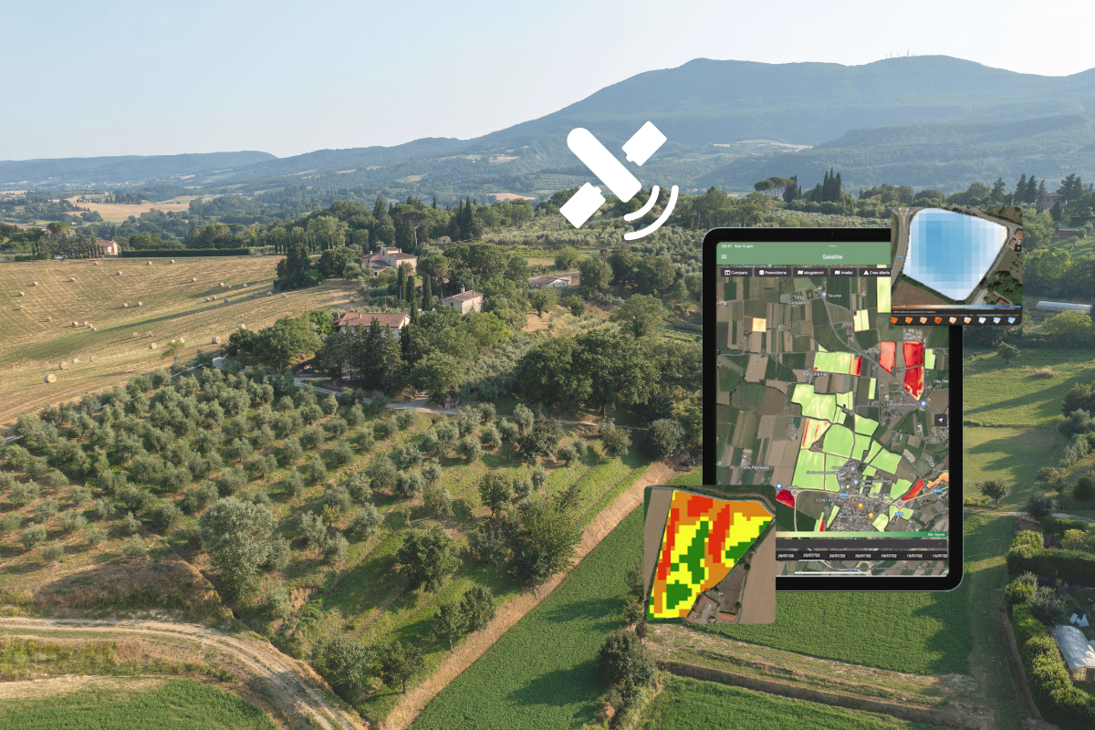
Satellite imagery can be used to identify crops, hedgerows, waterways, pastures and even specific regenerative agriculture practices such as crop rotation, cover crops or tillage.
This is done by training AI models to analyse one or more satellite images and detect specific features. The images we use are very information-rich and can provide data that is not visible to the naked eye, such as infrared signals. This allows the model to associate specific visual cues with particular crops or practices.

This use of satellite data is crucial to making the MRV mechanism financially viable. The alternative would be to send drones, planes or people in cars to carry out verifications. This would be very time-consuming and costly. Satellite data, on the other hand, is provided by multiple government organisations around the world on a weekly basis.
Of course, there are challenges to using satellites. Cloud cover can sometimes limit the information we can get, especially in some tropical regions of the world. The models, although very good, are not always correct and need to be improved over time. It is also necessary to have a way of manually checking the output in case the satellite image model has made a mistake. It is very important to keep this transparency mechanism at the core of the MRV principle, and this is what we do at xFarm Technologies.

In conclusion, MRV is an important tool for the regenerative agriculture movement. The use of innovative tools such as satellite imagery and AI models for MRV reporting allows the verification process to be scaled up, allowing for the analysis of larger areas and thus contributing to the expansion of regenerative practices. And while MRV does not actually store carbon or improve soil biodiversity, it helps create the trust and transparency needed to implement systems that pay farmers for their efforts to farm more sustainably.


.svg)